Our plan is to take about 14-18 months and travel along the Leeward and Windward Island Chain from Puerto Rico to S. America. We are planning on leaving soon after this Hurricane Season 2015 and get South of 5 degrees Latitude before June 15th, 2016.
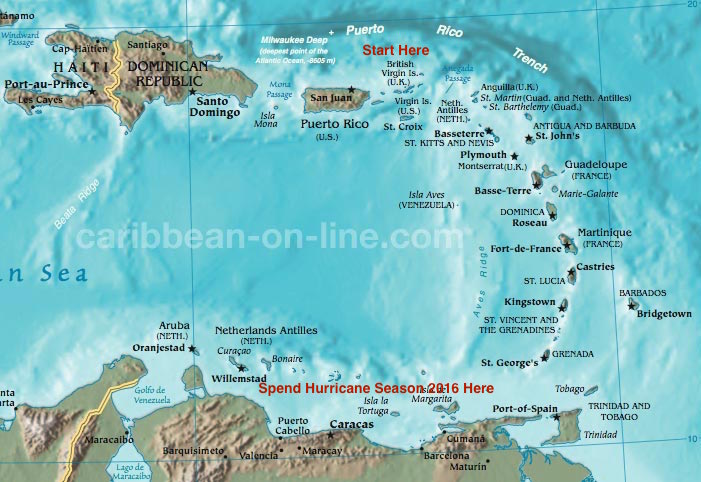
Early November 2016, we will work our way back North and get back to St. Thomas sometime in January 2017.
These islands are relatively easy to Navigate and the weather patterns are pretty predictable. These islands were formed from Volcanos along the Caribbean Plate. There is still an active Volcano on the island of Montserrat and an active underwater Volcano near Granada.
Since these Islands are along an active fault line so there are small Earthquakes almost everyday, but most aren’t even felt.
Each Island is very different and has its own personality. Some islands are independant countries, such as Trinidad and Tobago. Others, like the British Virgin Islands, Montserrat and Anguilla are British. Saint Martin is one island, but spelled 2 different ways depending upon which side you are on. St.Martin is for the French side; St.Maartin is the Dutch side. St. Barts (Barthelemy) is known as the Mediterranean of the Caribbean because of the large yachts that are constantly parked in its harbor. St. Kitts is known as the island of Monkeys.
Every island is a picture perfect paradise just waiting to be hiked, snorkeled and explored!!!

Leave a comment